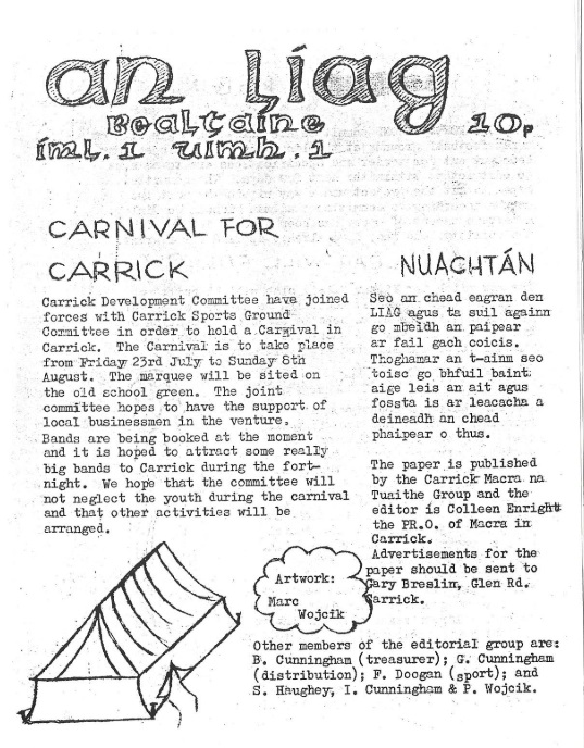
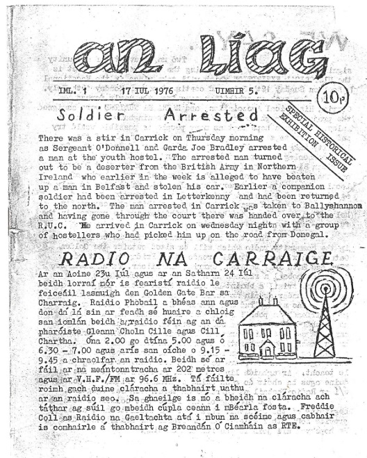
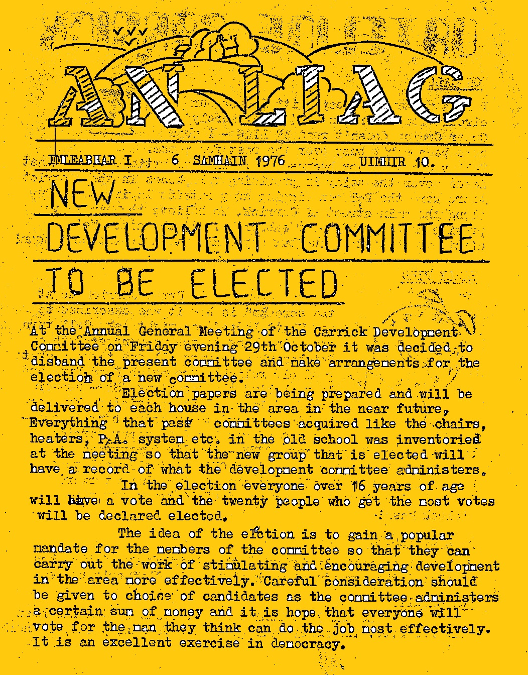
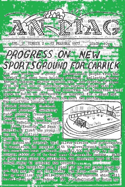
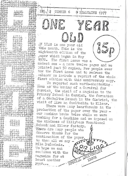
History
I hope to have all copies of An Liag on here at some stage soon I have all the copies I got from people now online I am missing a good few issues if you have any that are not on here I would be very grateful if I could get a lend of them and I will scan them and return them to you, contact James at 086-9969256 or you can post them to James Byrne, Back Lane, Carrick Upper, Carrick.
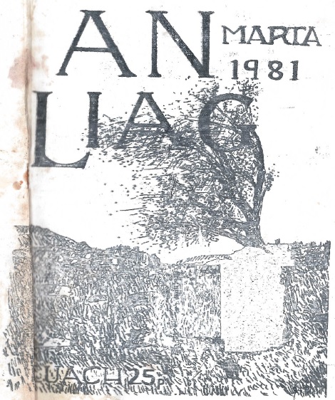
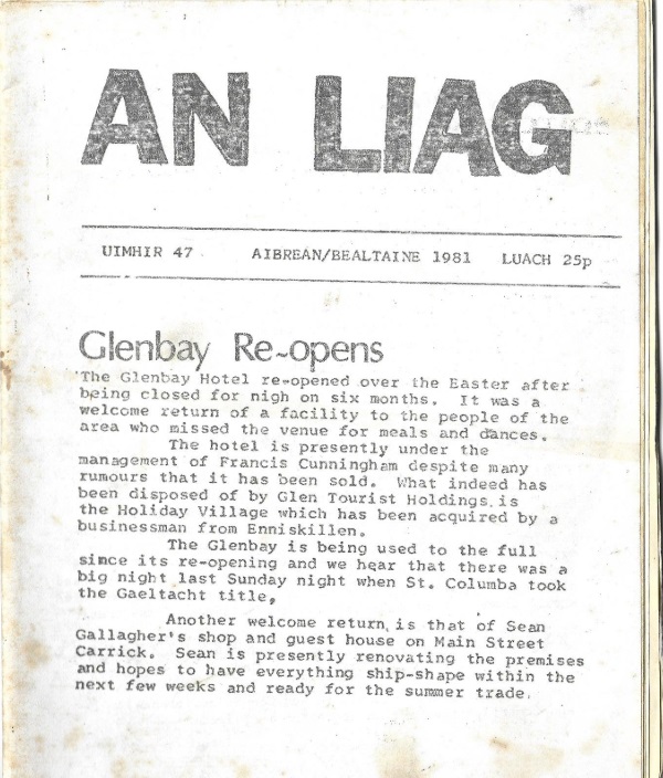
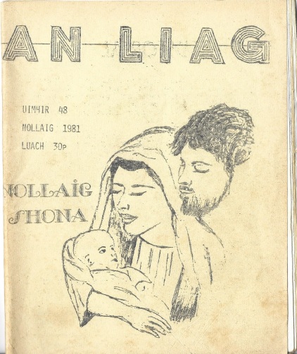
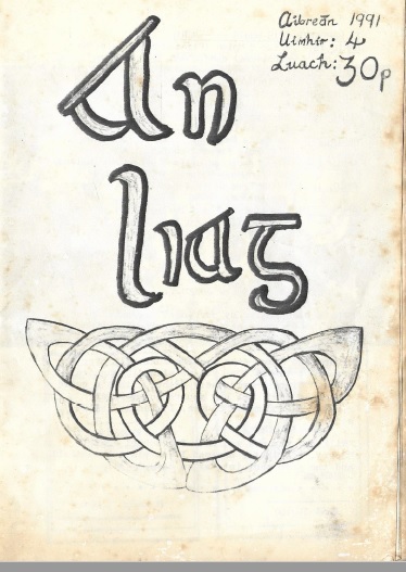
Click cover to read.


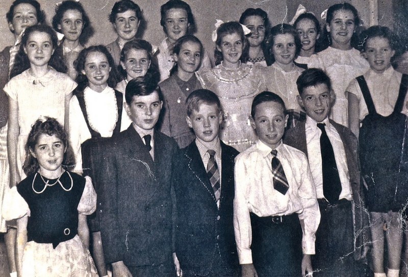
Carrick National School Choir 1959
We recently came across this wonderful photo of Carrick National School Choir taken in 1959 we hope to have all the names filled in soon and if you can name them all email us at This email address is being protected from spambots. You need JavaScript enabled to view it..
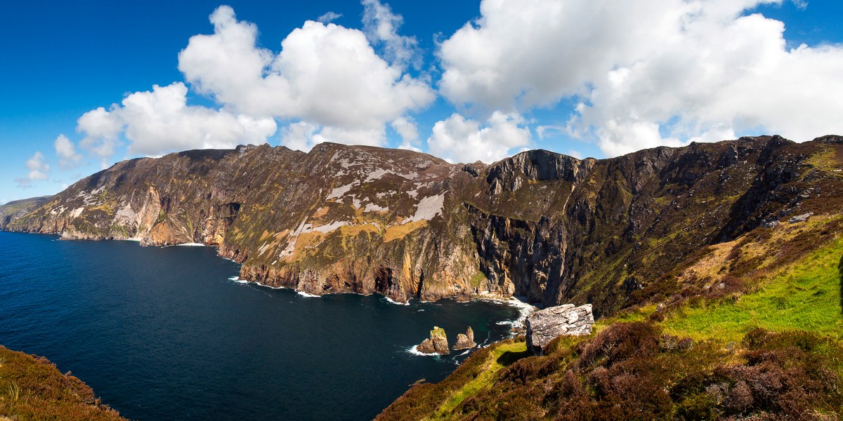
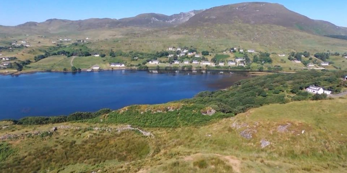
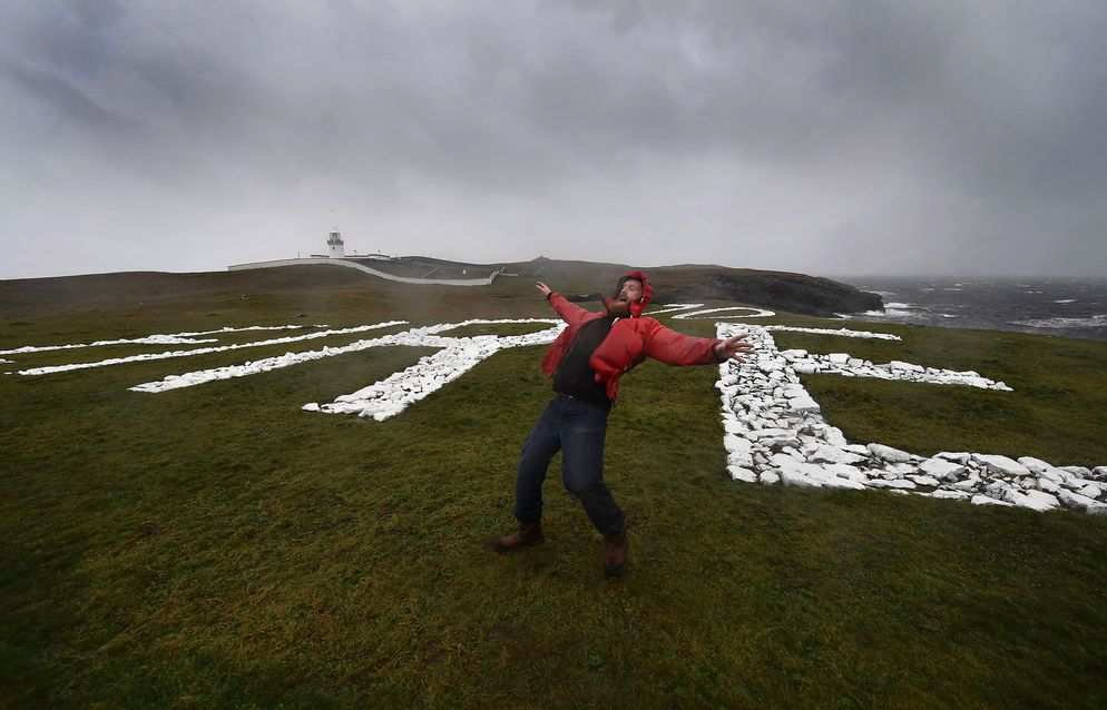
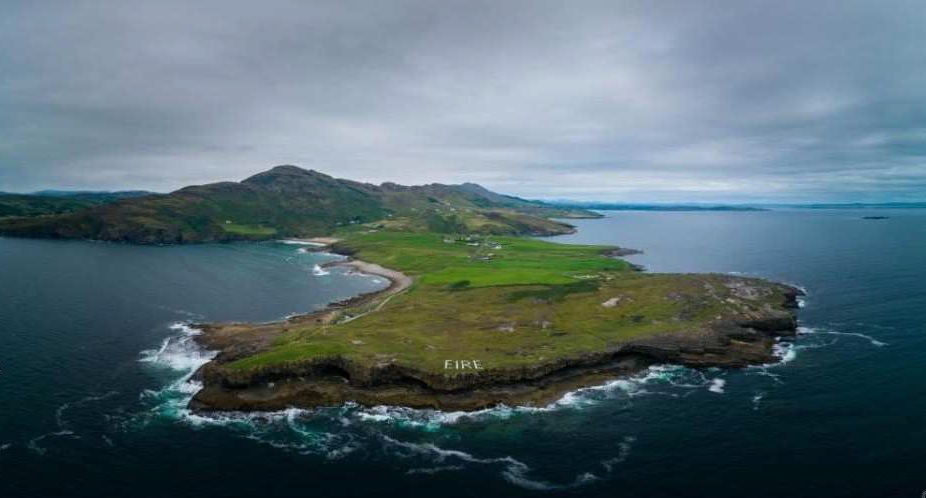
LOP 71 at Carrigeen Head
LOP 71 on Carrigeen Head by Joe Gallagher
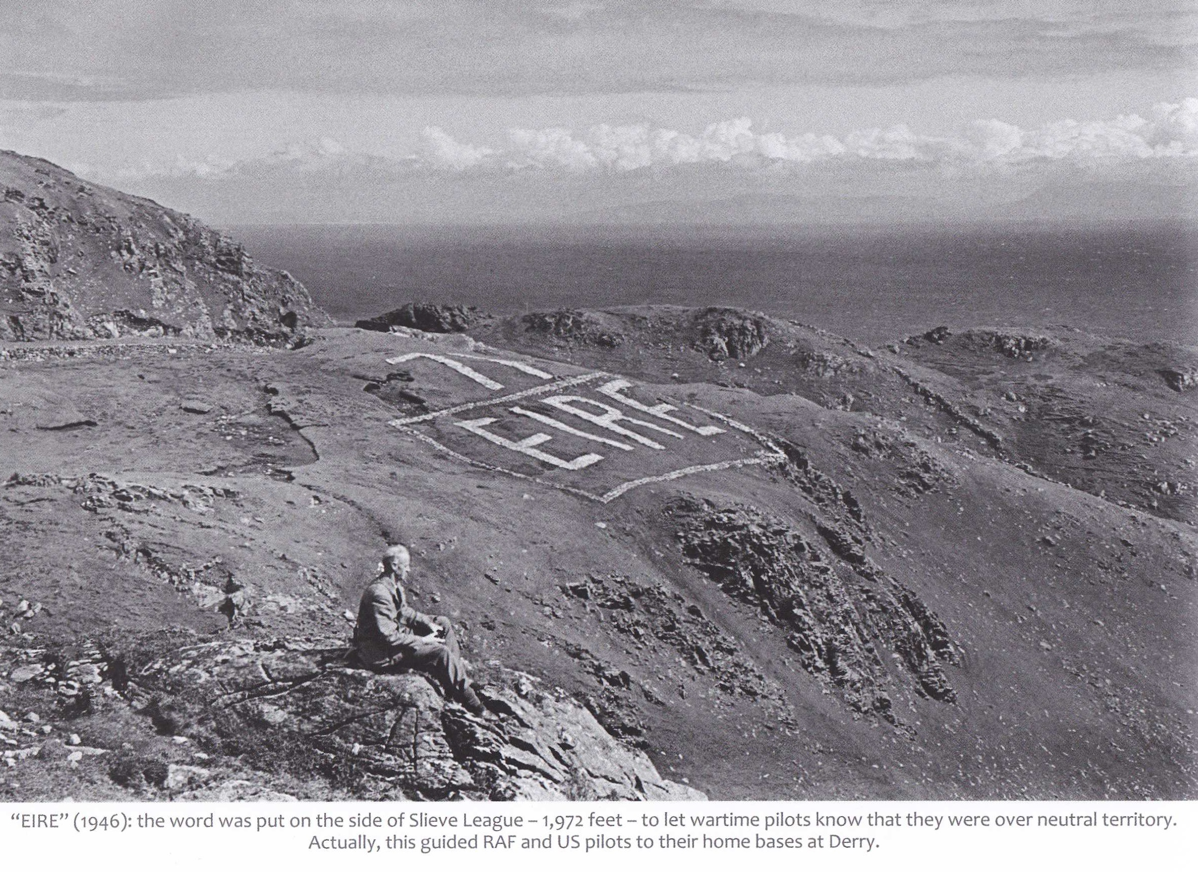
This EIRE 71 Sign is on the road to Bunglas and near the Look Out Post on Carrigan Head. I found it on Page 62 of Father Browne's DONEGAL 2015. Father Browne was one of the two Jesuit Fathers who gave the Mission in Carrick and Glencolmcille in 1945? The LOP Sign was still in pristine condition as the War had just ended.
I found this Photograph (page 1) in Father Browne's Donegal 2015. The date given is 1946 but I think that it was taken in 1945. Fr. Browne was one of the two Jesuits who gave the Mission in Carrick and Glencolmcille in 1945. The Missioners stayed in Jim William Cunningham's house, Carrick. There are 30 Photographs of Teelin, Carrick and Glencolmcille in this book.
The Eire Aerial Markers near Look Out Posts were first laid out in 1939-40 to indicate to low flying aircraft that they were overflying the neutral Irish Free State. By 1944 the Americans were preparing for the D-Day Landings and they were flying Boeing B-29 Super-fortresses, which could fly at over 30,000 feet! The Irish government decided to enlarge the Eire Aerial Markers and David Grey, US Minister in the American Legation in Dublin insisted that the Number of the Local Look Out Post be added to the Aerial Markers. Thus, the Aerial Markers became Navigational Aids for the high-flying Aircraft. See pp 49, 244-252 of Guarding Neutral Ireland 2008 by Dr. Michael Kennedy.
The platoon that laid Aerial Marker 71 Eire was billeted in the house of Paddy and Frank Cassidy, Cappagh—three doors away from my home. The Officer in charge was Captain John (Sonny the Bell) Mac Loone from Glenties. Sonny's account of the work was: “When we were doing the painting of the Eire sign, we ran out of white paint. There was a `Phone call made to the British Army in Ennishkillen and they sent the white paint down to us the next day. That's how neutral we were in World War II!” Later when I thought about Sonny's story, an Event came back to my mind—we lived just three doors away from the Cassidy home in 1944. One evening while the Irish Army soldiers were billeted there, my father sent me over to Paddy and Frank with a message. I went to the back door and knocked. A genial well-built man came to the door and said, “Who is the big man that we have here?” I believe that that man was Sonny the Bell. Unfortunately, I never got to tell Sonny the story, as he died suddenly shortly afterwards!
The names of the Coast-watchers who served at LOP 71 Carrigan Head were : Corporal Michael (Hill) McNelis. Volunteers: Andy Byrne; D. Cunningham; Jimmie P. Donegan; Jimmy Lyons; Barney Maloney; James G. Mulloy; Paddy McGill; Paddy J. McLoughlin; Hugh McNelis; Paddy (Shisealla) McNelis; Paddy (Beag) McShane. I found the names in p. 325 : Guarding Neutral Ireland 2008 by Dr. Michael Kennedy.
Notes: The late Anthony McNelis told me that Paddy O'Donnell from Dungloe served on Carrigan Head. Paddy O'Donnell's son, Seán, confirms that. I note that a P. O'Donnell served at LOP 72 Rossan Point, Malinmore. I have not identified the D. Cunningham listed above—he may be the D. Cunningham listed on LOP 70, St. John's Point. When there was a man short at one Look Out Post, a member was taken from an adjacent LOP to make up a Crew.
The names of the Coast-watchers who served at LOP 72 Rossan Point: Corporal Colum M. Mockler. Volunteers: E. Boyle; H. Boyle; F. Cunningham; C. Kelly; C. Lyons; J. G. Mulloy; P. O'Donnell; P. O'Gara. I found the names in p. 325 : Guarding Neutral Ireland 2008 by Dr. Michael Kennedy.
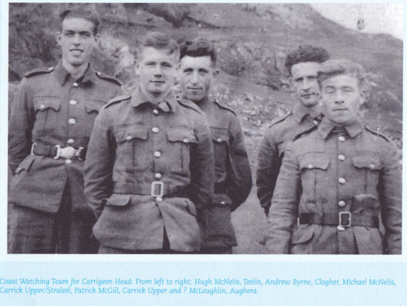
I found this Photograph in An Charraig—Carrick Reunion 2006. The full name of the man on the right is Paddy J. McLoughlin. Andrew Byrne died in America in 2015.
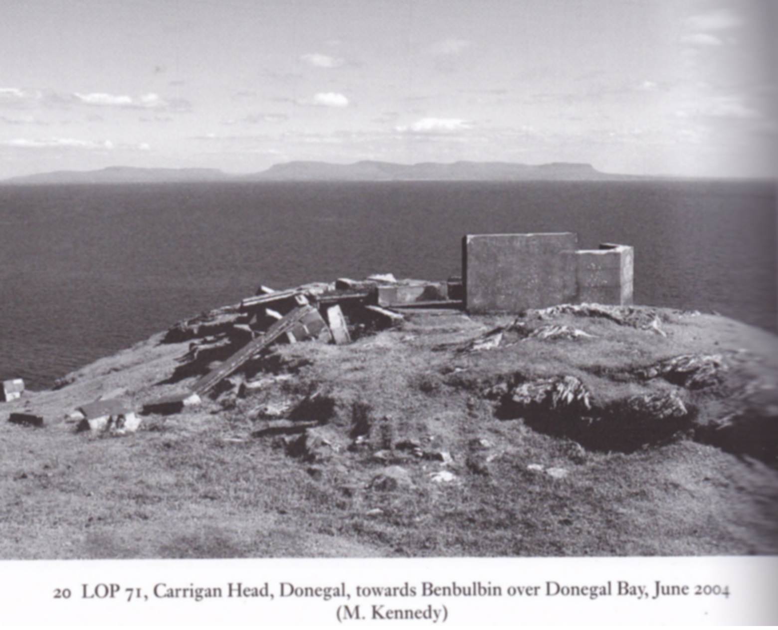
I found this Photograph of Carrigan Head in Guarding Neutral Ireland 2008 by Michael Kennedy.
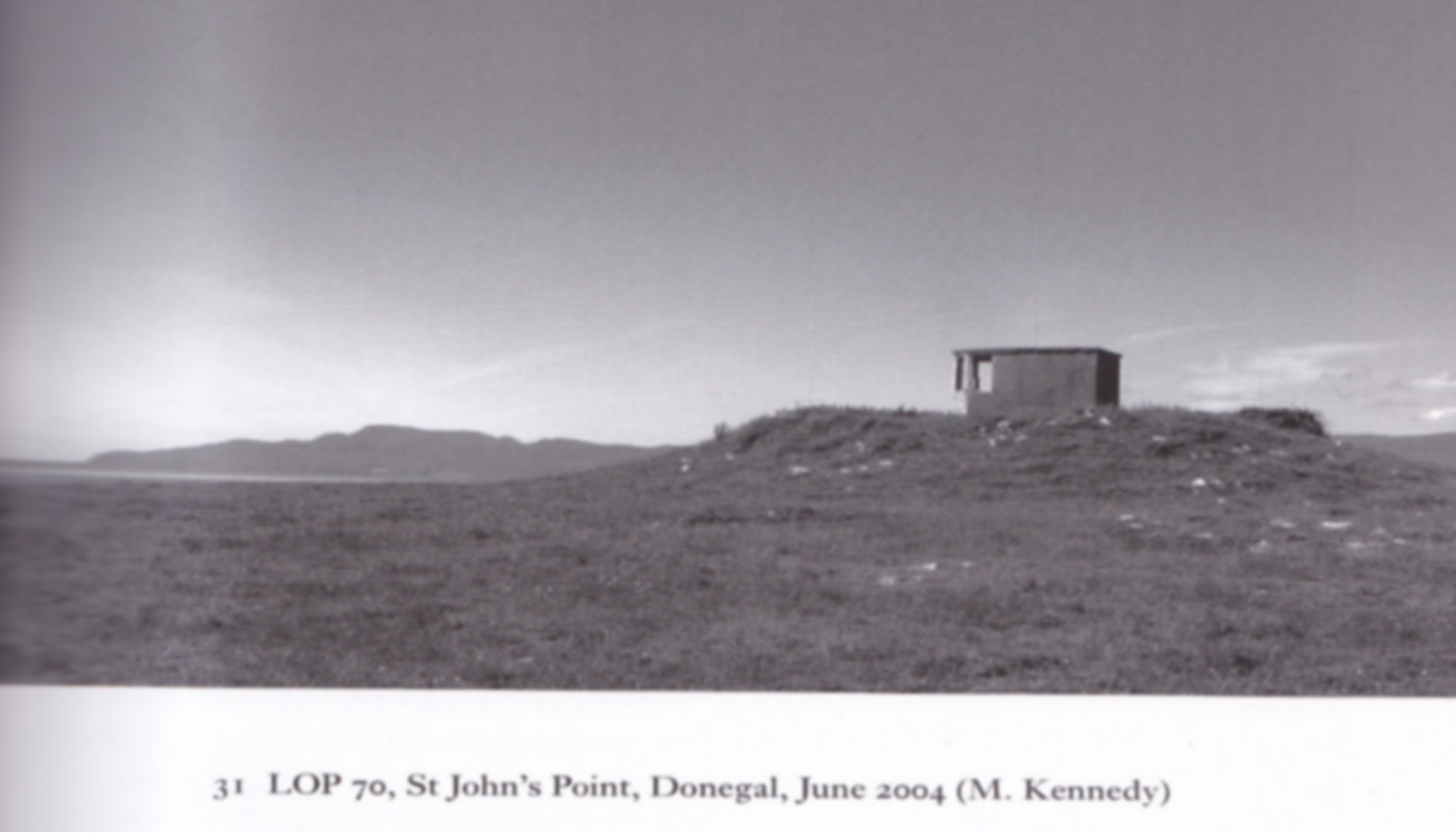
I found the above Photograph of St. John's Point in Guarding Neutral Ireland 2008 by Michael Kennedy. Note Teelin and Sliabh Liag in the Background.
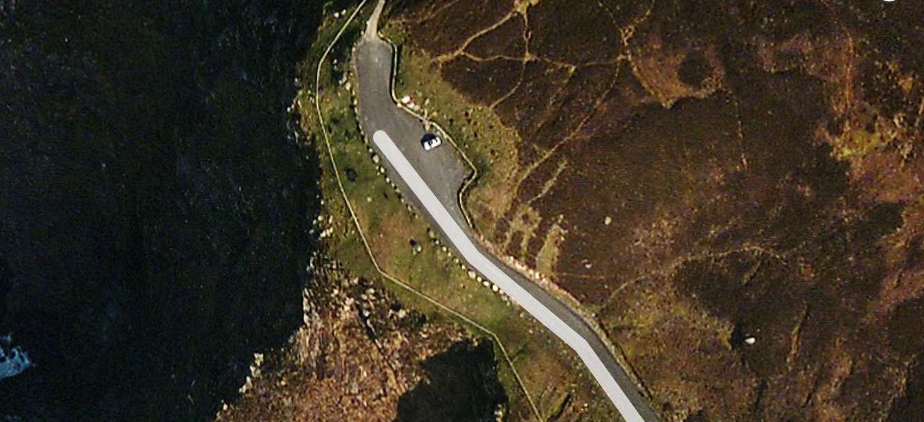
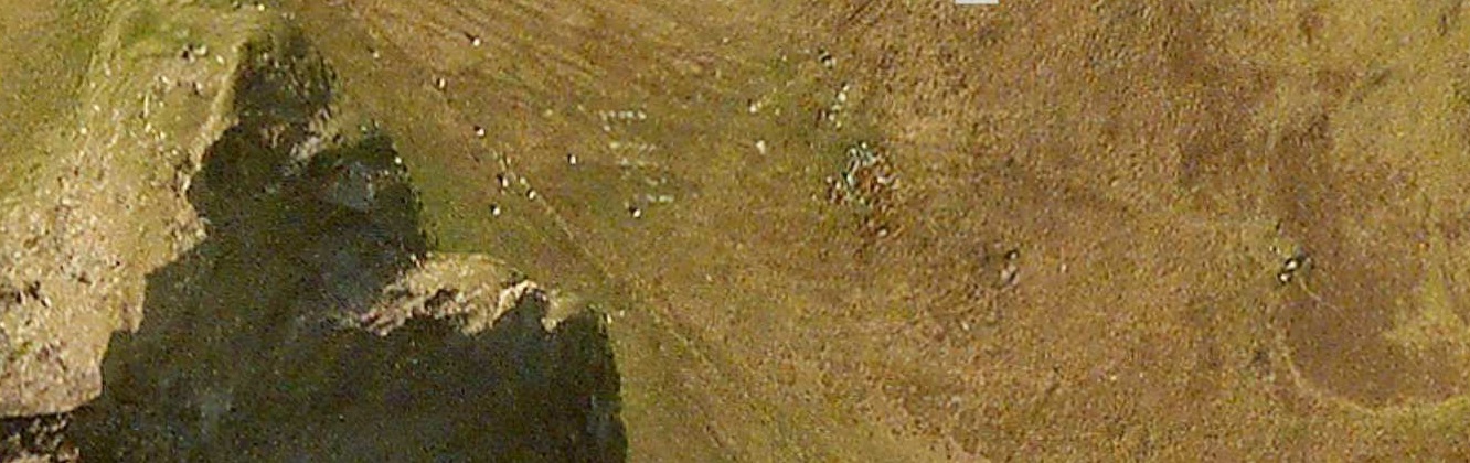
This is a recent Aerial Photograph of Bunglas Car Park area. In the centre of the photograph can be seen the remains of the original Carrigan Head LOP EIRE Sign?
This sign would have been made in 1939-40? I found this photograph on Website: http://eiremarkings.org/category/counties/donegal/
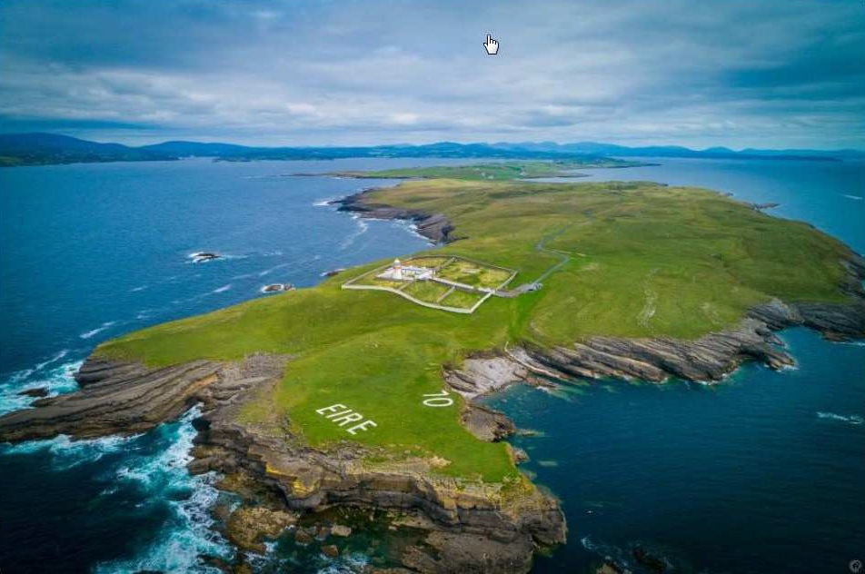
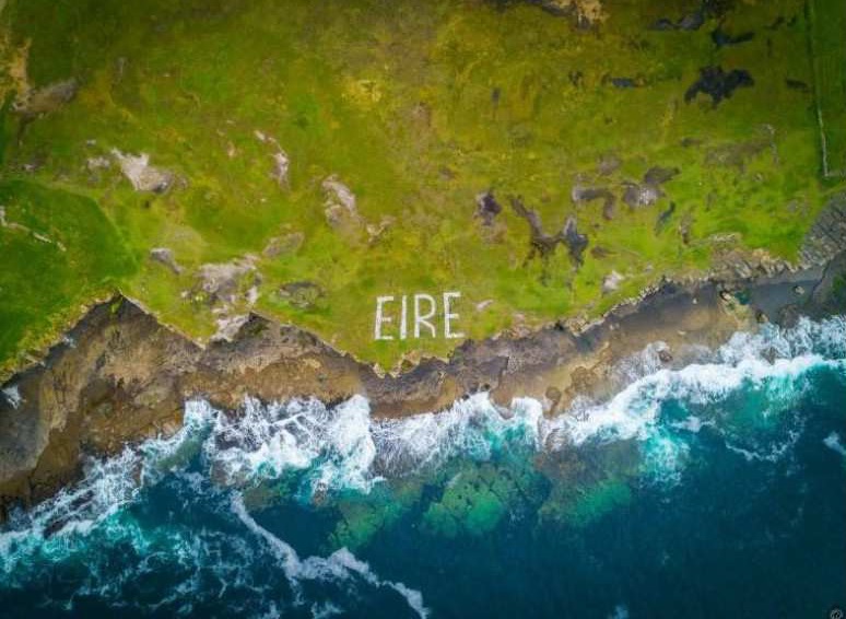
This is a Photograph of the Rossan Point Look Out Post Eire Sign 72. It is on the Ros Mór, Glencolmcille. The Sign can be seen to the left of centre of the photograph.
I don't know its exact position as I have not been wandering in that area for a long time (1951)! I found the photograph on Website: http://eiremarkings.org/category/counties/donegal/
This is LOP 170, St.John's Point Co. Donegal. The Sign is newly painted and restored. The Photograph was taken on Ophelia Day.
I found the Photographon the Internet under Dunkineely! Hopefully, the Carrageen Head 171 LOP will be restored as a Tourist and Heritage attraction.
This is a recent aerial Photograph of St. John's Point, Co. Donegal. It shows the newly restored Lop Eire 70 Sign. Note that the roadway extends to the Lighthouse.
I found the Photograph on the website: eiremarkings.org. Conor Corbett took the Photograph.
This is a Photograph of the LOP Sign on Mucros Head, Co. Donegal. This Sign was made in 1939-40. It was not enlarged in 1944 when LOP Sign 70 on St. John's Point
and LOP Sign 71 on Carrigan Head were enlarged. See notes on Page 2. I found the Photograph on website: eiremarkings.org
This is an aerial view of the Ros at Mucros showing the position of the Eire Sign. I found the Photograph on website: eiremarkings.org
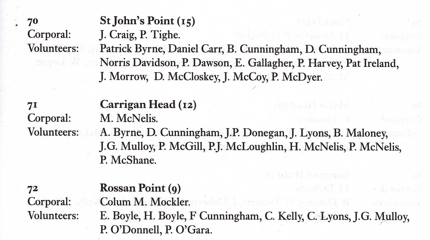
This is the list of the names of the Coast Watchers who served on LOP 70, St. John's Point; LOP 71, Carrigan Head; LOP Rossan Point. I found this list in Guarding Neutral Ireland 2008 by Michael Kennedy.
The Donegal corridor and the Battle of the Atlantic
From historyireland.com
As Europe fell to the advancing German armies in the early months of World War II, the United Kingdom became more and more isolated and increasingly dependent on the Atlantic trade route for industrial raw materials and food. Although some air cover was already provided, a gap existed in mid-Atlantic, a section which could not be reached from existing air bases. If U-boats could operate in this area without fear of air attack then Allied convoys would be at the mercy of German ‘wolf packs’.
As a result of aerial surveys carried out late in 1940 and despite a less than favourable report, construction of an RAF base began on the old Castle Archdale estate on the shores of Lough Erne with the intention of closing the gap. There was one snag. The extra 100 miles range possible from the new base would only become effective if the aircraft could fly due west over neutral Ireland. Failing an agreement, planes would have to fly north over Lough Foyle before heading for the Atlantic battleground.
While de Valera would not be coerced into joining the war, pragmatism demanded that, despite strained Anglo-Irish relations, an official blind eye be turned to what became known as the ‘Donegal corridor’, a route over south Donegal/north Leitrim/north Sligo and out to the Atlantic. This concession was subject to the provisos that flights would be at a good height and that the route over the military camp at Finner would be avoided, both of which conditions subsequently received scant attention from the British.
No. 240 Squadron, equipped with Stranraer flying boats, carried out the first sorties from the newly established base on Lough Erne, styled No. 15 Group Coastal Command, on 21 February 1941, thus bringing Fermanagh into the front line of the Battle of the Atlantic. One of the earliest and most notable successes was the location and chase that resulted in the sinking of the Bismarck. An entry in the Castle Archdale log for 27 May 1941 reads: ‘German battleship sunk at 11.00 hours. Aircraft of 209 and 240 squadrons operating from this station were responsible’.
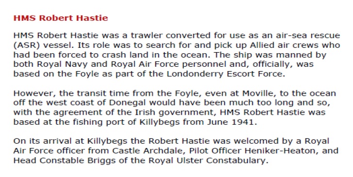
The ‘nod and a wink’ policy of ‘neutral Ireland’ extended to more than just a shortcut to the Atlantic. Other concessions followed. The establishment in June 1941 of an armed air/sea rescue trawler, the Robert Hastie, manned by eleven British personnel, at Killybegs, Co. Donegal, was shrouded in secrecy. Its purpose was to provide assistance to shipping casualties and to supply planes that had run out of fuel. The need for such a vessel was illustrated the previous April when Pilot Officer Denis Briggs, returning from a routine U-boat patrol, was forced to ditch his Saro Lerwick sea-plane in the sea off Tullan Strand, near Bundoran, when he ran out of fuel. Watching the descent of the stricken plane, Irish army observation posts shortly afterwards beheld the unusual sight of an airplane being towed to Bundoran by a passing fishing-boat and immediately reported the incident to HQ. This was a new dilemma for all involved. Local units of the Irish Army, unaware of decisions made at a higher level, proceeded on the assumption that the crew would be interned for the duration of the war and the plane impounded. Following some hasty consultation and diplomatic manoeuvring, a camouflaged airforce lorry arrived from across the border with 80 gallons of aviation fuel. The plane was made ready and took off with its crew for their home base on Lough Erne.
On the evening of 5 December 1942 people from all over north Sligo looked up into a lowering winter sky, watching fearfully as a huge Flying Fortress circled noisily overhead looking for a safe place to land. ‘The Devil Himself’, as it was called, created a sensation when it dropped safely out of the sky onto Mullaghmore beach. The crew of American officers and airmen were fêted in the Beach Hotel, Mullaghmore, and at Finner camp for seventeen days while a replace-ment engine was supplied from Northern Ireland and fitted to the plane. A local man did well when he received £2 compensation from the Irish Air Corps for damage to his land!
Cooperation between the British and Irish authorities was soon commonplace, eventually becoming so close that in some instances HQ in Athlone could inform Castle Archdale of downed planes in Irish territory before the British even knew they were missing! There were approximately 162 wartime crashes or forced landings in southern Ireland. Below are others that occurred in the north-west:
24 January 1941, 17.00 hours, Lockheed Hudson reconnaissance bomber, RAF 233 Squadron, forced to land at Skreen, Co. Sligo (out of fuel). Repaired and flown to Baldonnell at 19.15 hours,26 March 1941. Four survivors, two missing. Two carrier pigeons taken into custody and sent to the Curragh!
21 March 1941, Catalina flying boat, 240 Squadron, Castle Archdale, crashed on the mountain near Glenade, Co. Leitrim. Nine dead, no survivors. The plane was completely wrecked.
30 April 1941, plane based at Limavady crashed at Askill, on Ballyshannon to Garrison road, Co. Donegal. Crew baled out safely.
21 July 1941, 19.00 hours, British Lockheed Hudson forced to land on Tragh Bui, Ballyconnell, Co. Sligo. Took off at 13.40 hours for Limavady. No casualties.
17 November 1942, 16.25 hours, Catalina flying boat en route from Bermuda to Scotland forced to land on Lough Gill, Co. Sligo. Crew of six unhurt. Refuelled and took off at 16.35 hours, 19 November 1942.
10 May 1943, 09.00 hours, B-17 Flying Fortress, 524th Bomb Squadron, en route from Gander, Newfoundland, to Prestwick, Scotland, forced to land (out of fuel) at Tullan Strand, Finner, Co. Donegal. Crew of ten unhurt. Aircraft dismantled and conveyed to Northern Ireland on low-loader.
9 December 1943, 17.19 hours, B-25 Flying Fortess, en route from Goose Bay, Canada, to Prestwick, crashed on Truskmore Mountain, Ballintrillick, Co. Sligo. Three dead, seven injured; plane a total wreck.
23 January 1944, 18.40 hours, British Halifax bomber struck cliff at Fairy Bridges, Bundoran, Co. Donegal. Completely wrecked; six bodies recovered, four washed out to sea.
31 January 1944, 23.30 hours, Sunderland flying boat DW 110, 228 Squadron, Castle Archdale, crashed at Bluestack Mountains near Brockagh, Co. Donegal. Seven killed, five injured.
20 February 1944, 18.10 hours, B-17 Flying Fortress forced to land (out of fuel) on Fintragh Strand, Killybegs, Co. Donegal. Plane submerged at high tide, becoming a total loss; ten injured.
5 May 1944, 09.15 hours, B24 US Liberator forced to land (out of fuel) at Carradreshy, Foxford, Co. Mayo. Crew of ten uninjured. Partially salvaged and handed over to RAF, Northern Ireland, on 1 June 1944.
19 June 1944, 22.50 hours, American Flying Fortress bomber forced down (engine failure) on the land of Hamilton Black, Sheegus, north-west of Ballyshannon, Co. Donegal. Two killed, seven injured, one unscathed. Plane badly damaged; handed over to US forces in Northern Ireland.
12 August 1944, 11.55 hours, British Sunderland, Squadron RCAF 422, Castle Archdale, crashed (engine failure) on Breesy Mountain near Belleek, Co. Fermanagh. Three killed out of crew of twelve. Surviving three engines and rear turret handed over to RAF in Northern Ireland.
4 September 1944, 21.00 hours, British Swordfish torpedo and reconnaissance biplane forced to land at Carrowcastle, Skreen, Co. Sligo. No injuries. Stephen Foley’s hen house destroyed, thirty chickens killed and half an acre of cabbage ruined! Plane dismantled and handed over to RAF in Northern Ireland, 10 September 1944.
17 December 1944, 16.20 hours, British Martinet, Squadron 131, forced to land on Classiebawn estate, Mullaghmore, Co. Sligo. No injuries. Wreckage salvaged and transferred to RAF in Northern Ireland by low-loader, 21 December 1944.
14 March 1945, 02.30 hours, British Sunderland, 201 Squadron, crashed on Fintragh Mountain, Clane, Killybegs. Crew of twelve killed; plane completely wrecked.
9 February 1945, 16.30 hours, British Halifax bomber forced to land in sea one mile east of Mullaghmore Head, Co. Sligo. Four survived, two drowned; one body recovered at Rossnowlagh and one at Mountcharles, Co. Donegal. Privates Herrity and Gilmartin of Mullaghmore commended on prompt reporting to Killybegs lifeboat, resulting in rescue of survivors.
Joe Mc Gowan is a local historian living in Mullaghmore, County Sligo and author of Constance Markievicz: the people’s countess.
Bruckless Drownings
**UPDATE 15 June 2021, Joseph Gallagher was doing some research into this and found details of a storm that passed over during the time of the tragedy so this would clear Mrs Deveney’s name.**
The Storminess Record from Armagh Observatory, N. Ireland 1796-2002.
Armagh Observatory was established in 1790 by Archbishop Richard Robinson. Robinson was the Church of Ireland Archbishop of Armagh (Butler and Hoskins 1987). Although the main focus of the Observatory was astronomy, daily meteorological records were kept from 1794, when the Observatory became operational. Only air temperature and barometric pressure were recorded during 1794 and 1795. From 1796 to 1843 wind direction was also recorded and a brief written daily weather comment was also included in the daily weather register.
The daily description of weather included reference to storms and their effects. The only gap in the record is from mid-1825 to 1832 when no weather data was collected. In addition, no daily weather descriptions were recorded for 1883. From 1844 to the present there is also wind strength data, mostly instrumental but also some observer data. This makes this dataset the longest ongoing weather record on the island of Ireland. The Observatory is located on top of a drumlin on its own site of approximately 14 acres.
The Observatory although located on the edge of Armagh city is still predominantly surrounded by farmland and the playing fields of a number of schools. The city has grown in size from around 7,000 to 15,000 people over the study period and is highly dispersed and low density. A study by Coughlin and Butler (1998) showed the effects of urbanisation on the mean air temperature at the Observatory were minimal. However, the one threat to the quality of the wind data from the Observatory was the growth of trees around the main building.
This led to the original cup anemometer on the roof of the Observatory to be abandoned in favour of the more suitable site of the Back Lawn where the current meteorological site is located. This paper will examine the weather diary record of storms in Armagh from 1796 to 1999 and the instrumental/observation record from 1844-1999 and will highlight some of the difficulties in assembling such chronologies, even from one site.
The weather diary record from 1796-1999
This data was abstracted from the daily weather diary. From the earliest weather diaries the recording of storms seems to have been a key component of the description (Appendix 1). The definition of a storm used was the use of the words tempest , storm o r gale in the written description.
The description must clearly indicate that this event was not a gust, thunderstorm or snowstorm and that the wind was sustained for a length of time. Table 1 contains a brief list of some of the most noteworthy storms that have affected Armagh as recorded in the weather diaries.
Weather Records For February 1813
1813 1 6 Stormy and wet (S)
1813 1 10 Clouded and hazy with some light rain - wet and stormy night (SW)
1813 2 8 Blowing and mostly raining. Stormy and wet bright later (SW)
1813 2 12 Very clouded. A very stormy and wet night (WNW)
1813 2 15 Clouded and blowing with rain afternoon. Stormy night (WSW)
1813 2 19 Blowing, with some rain. Stormy at night (SW)
1813 2 20 Blowing, but mostly fair. Wet and very stormy night (SW)
1813 2 21 Fine morning - very wet afternoon - very stormy night (SSE SSW)
1813 2 26 Stormy morning with some rain. Blowing day with flying clouds. Stormy night, with rains (SW)
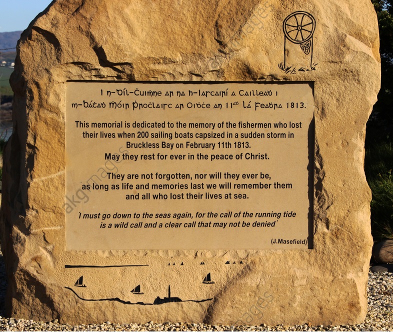
The Bruckless Drownings
On the 13th February 1813 a very sad happening occurred in Bruckless Bay. It was the drowning of crews of fishermen which consisted of eighty men. It was one calm, moonlight night and they were out looking at their nets and the young boys were singing and enjoying themselves and the old men smoking when all of a sudden a great storm arose and the boats capsized and most of the men were drowned.
A few men from this locality were saved because they all the creeks. The men who were drowned were from Teelin, Fintragh and Mullac-mor. This how the great storm arose. On a little hill overlooking Bruckless there stood a little cottage and an old witch and her daughter lived there with another woman. The witch's name was Katie Deveney and one [day?] she went down to the shore and asked the men for a few fish.
They refused to give her any as they did not like the old hag. Next day she sat on the little hill until she saw the fishermen out and she went down to her home and got a tub and filled it with water and left it outside the house. Then she went into the house and got a basin and she put it floating on the water in the tub. Then she came back into the house and began to work magic. After a few hours she sent her daughter out to see the basin, and when the daughter came in she told her it was rolling. After a while she sent her out again and when the daughter returned she told her that it was rolling faster.
A third time she sent her out and when she came in she told her mother it was turned over. "Well" said the old hag "It is time for us to be going", and from that day to this day they were never seen or heard of. The tub with the water represented the sea, the basin represented the boat and when the basin was rolling it meant that the sea was rough and the boat was rocking and when the basin turned over it meant the boats (ca) were capsized.
That was the greatest drowning ever happened around the coast of Donegal. The men from Teelin, Fintragh etc. were taken home on a wagon drawn by two bullocks and it is said that it was very sad to see the heart-broken wives coming out to see their husbands and sons taken home. As there was a tannery in Bruckless the boss gave the two oxen and wagon to take the dead bodies home.
Click here for detailed research by Joe Gallagher about the tragedy.
DROWNING IN BRUCKLESS. (JOHN MC FADDEN)
John’s great grandfather was one of the only survivors of the disaster. Only a few boats came home safe. He had been in one, and they put nets out of both sides of the boat to keep it steady. Forty eight to forty nine from Kilcar drowned. They had been fishing herring.
It has been said that an old lady - a witch of sorts had been refused fish. She had a saucer in a tub of water which she kept pouring water on repeating each time the saucer hit the bottom “that’s another gone now”. A storm caused the drowning.
Gravestones in the old St. Cartha church give accounts of those who died in the tragedy. Superstitious fishermen would turn back and go home if they met a red haired woman. (same if taking cattle to the fair).
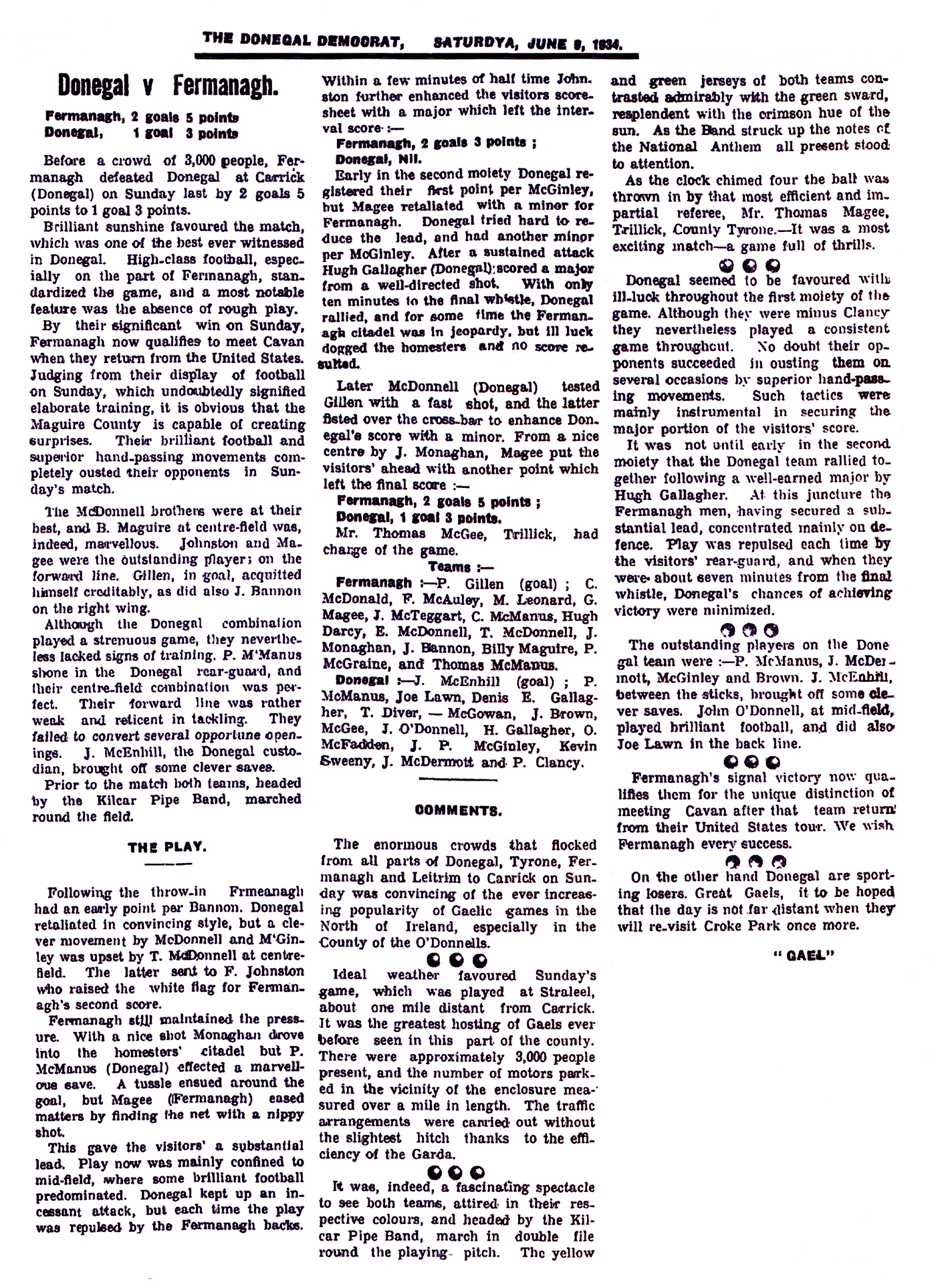
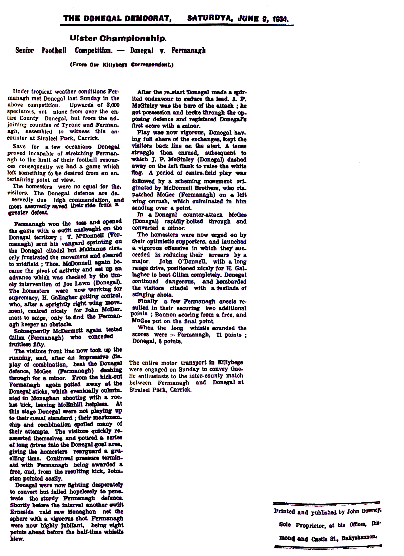
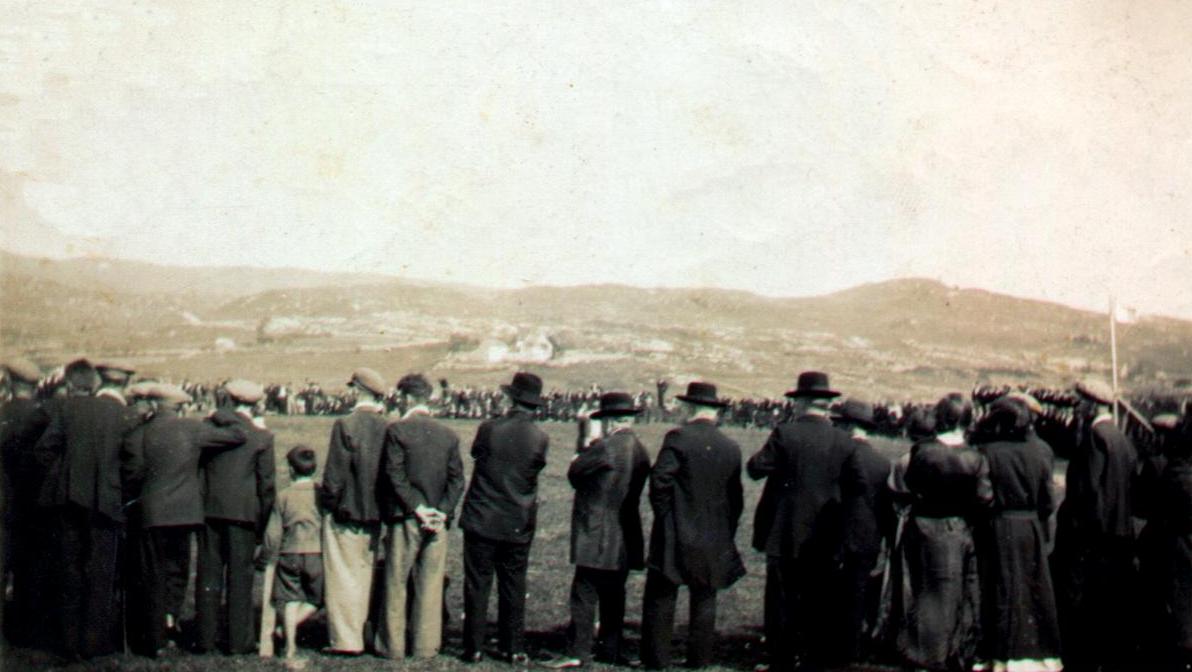
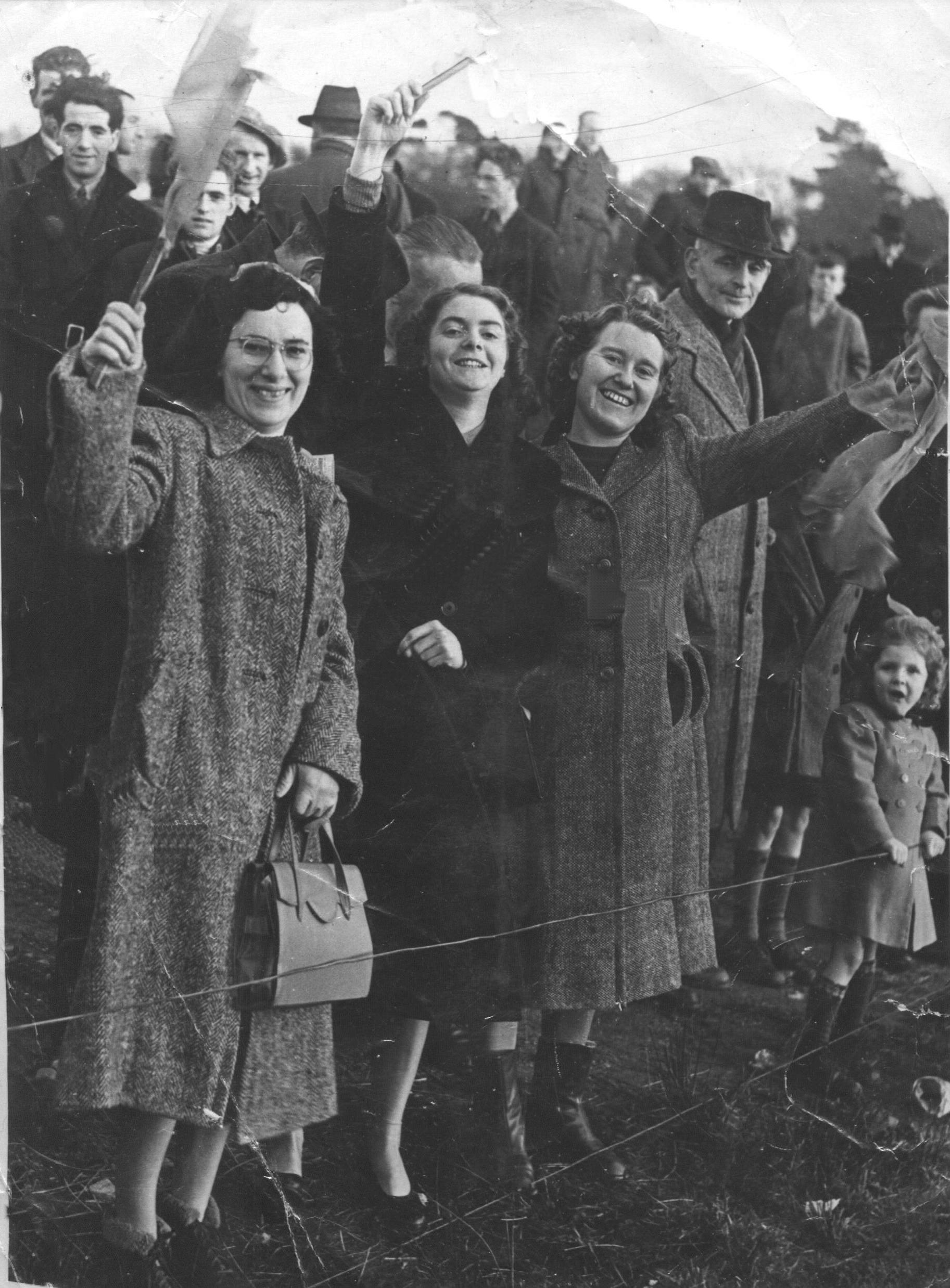
Donegal v Fermanagh in Straleel 1934
On Sunday 3 June 1934 Straleel hosted an Ulster Senior Championship Quarter Final match where Fermanagh were the visitors, its reported over 3,000 attended with Fermanagh winning 2-05 to 1-03. John Brown from Carrick and JP McGinley from Uminskin were on the team that day. If anyone has any other information or photos from this match can they pass them on?
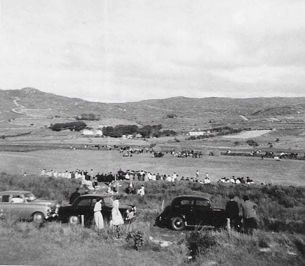
Thanks to Martina Byrne for the above photo
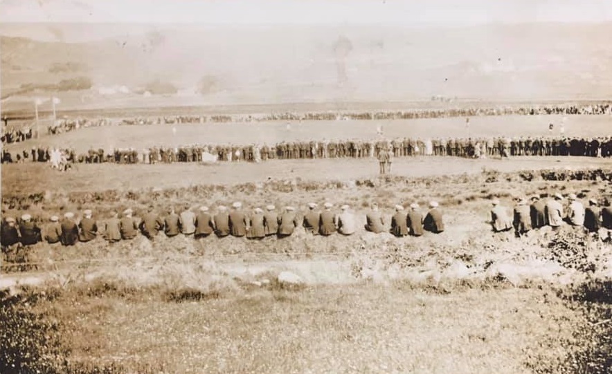
Thanks to Marcella Byrne for the above photo
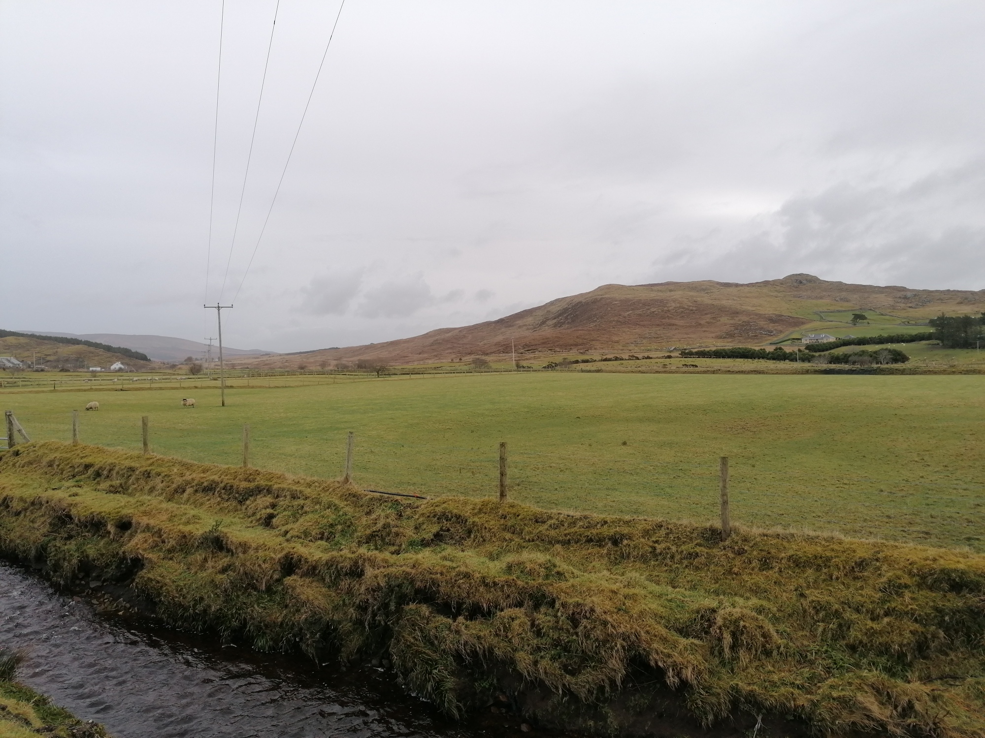
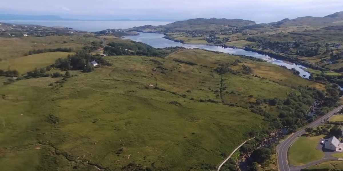
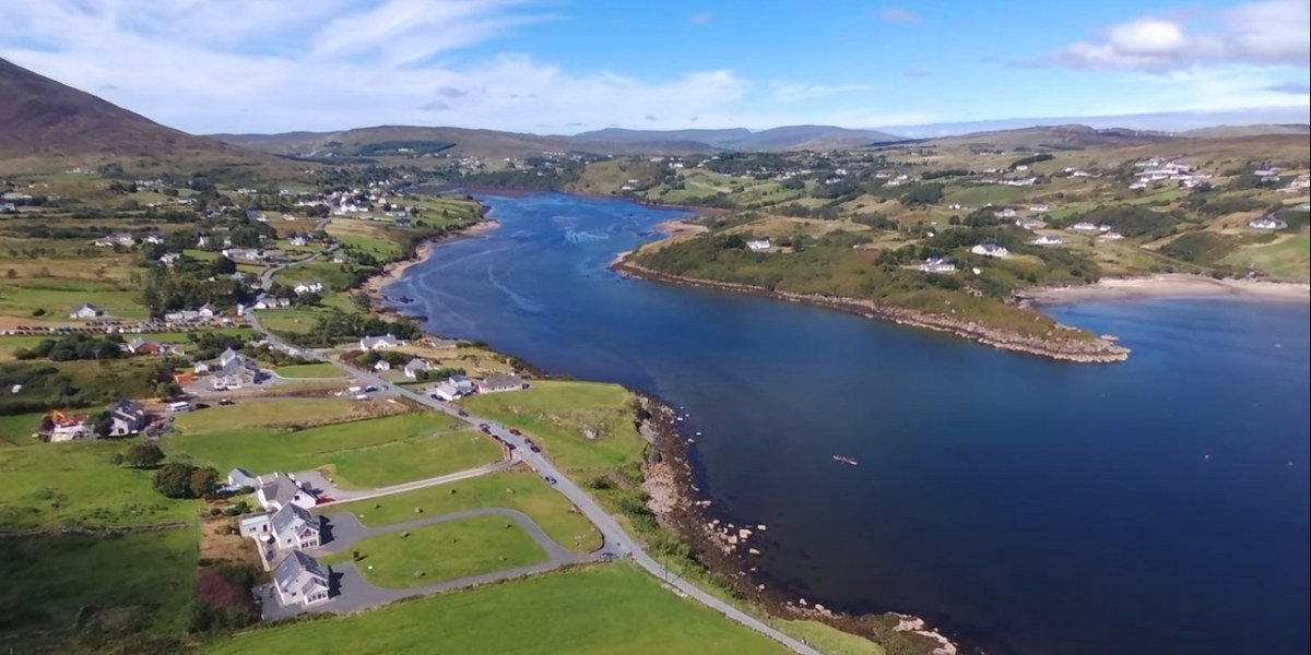
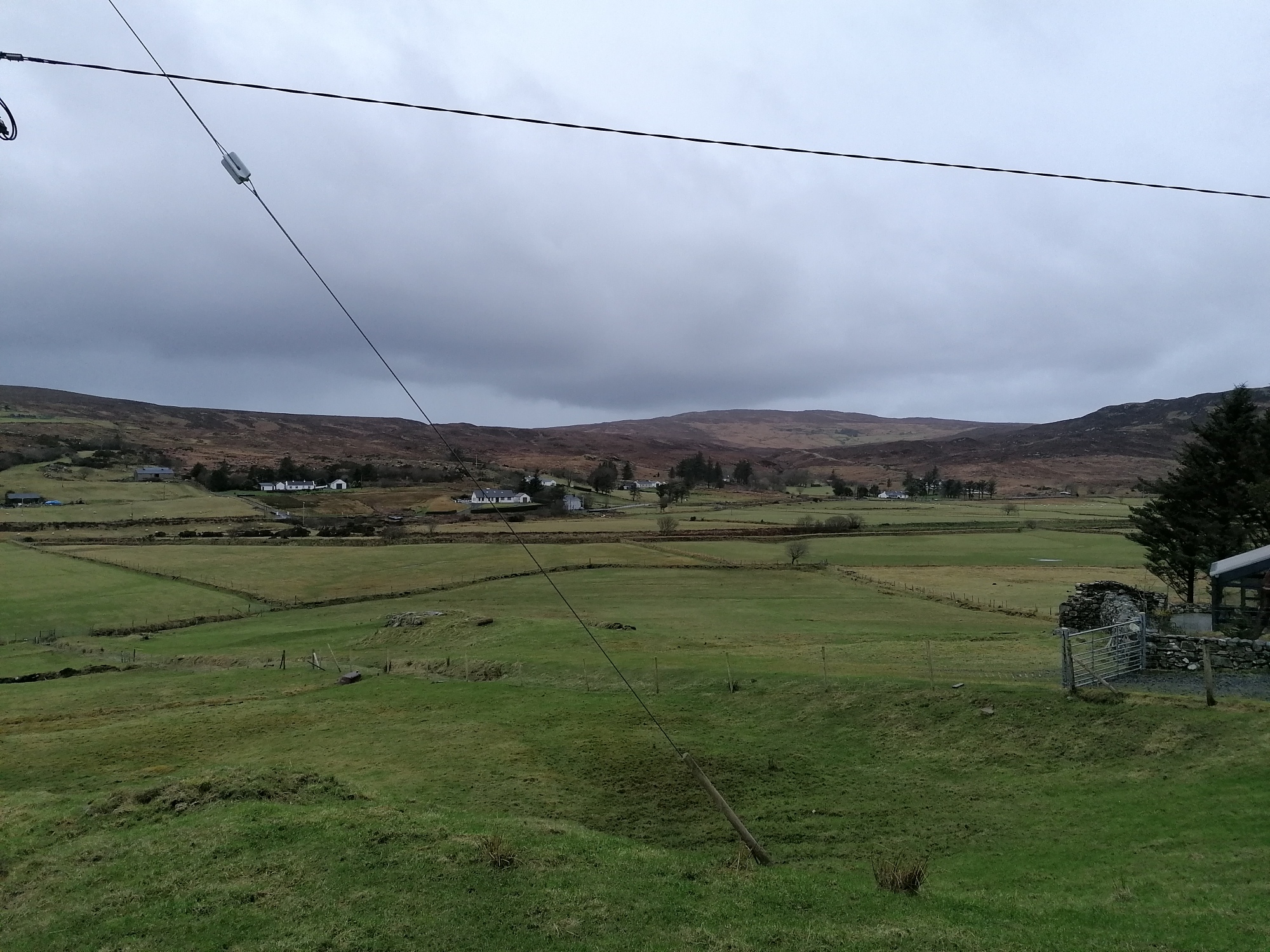
As it is today in 2021 from the Meenaneary Road
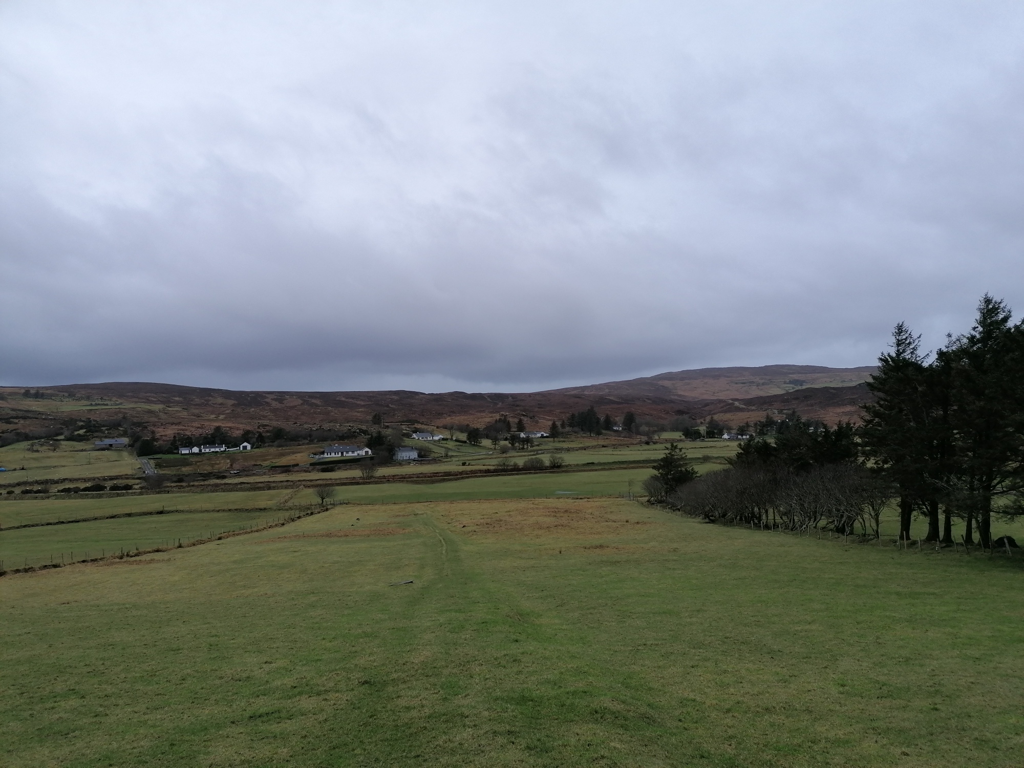
The above two pictures are from the Bogagh side of the river